Activities
Salish Sea Studies offers engaged and experiential learning opportunities. The activities here have been designed by educators for use in a variety of classes. You are welcome to adopt and adapt these activities to your learning environment.
Three Highlighted Examples of Activities

Historical Marker
How do we connect stories of people to place? The objective of this three-part project is to make the connection between the forced removal of Bellingham’s Punjabi community in 1907 to the history of Bellingham’s contested waterfront by creating a historical marker for the site.
Embodied Mapping
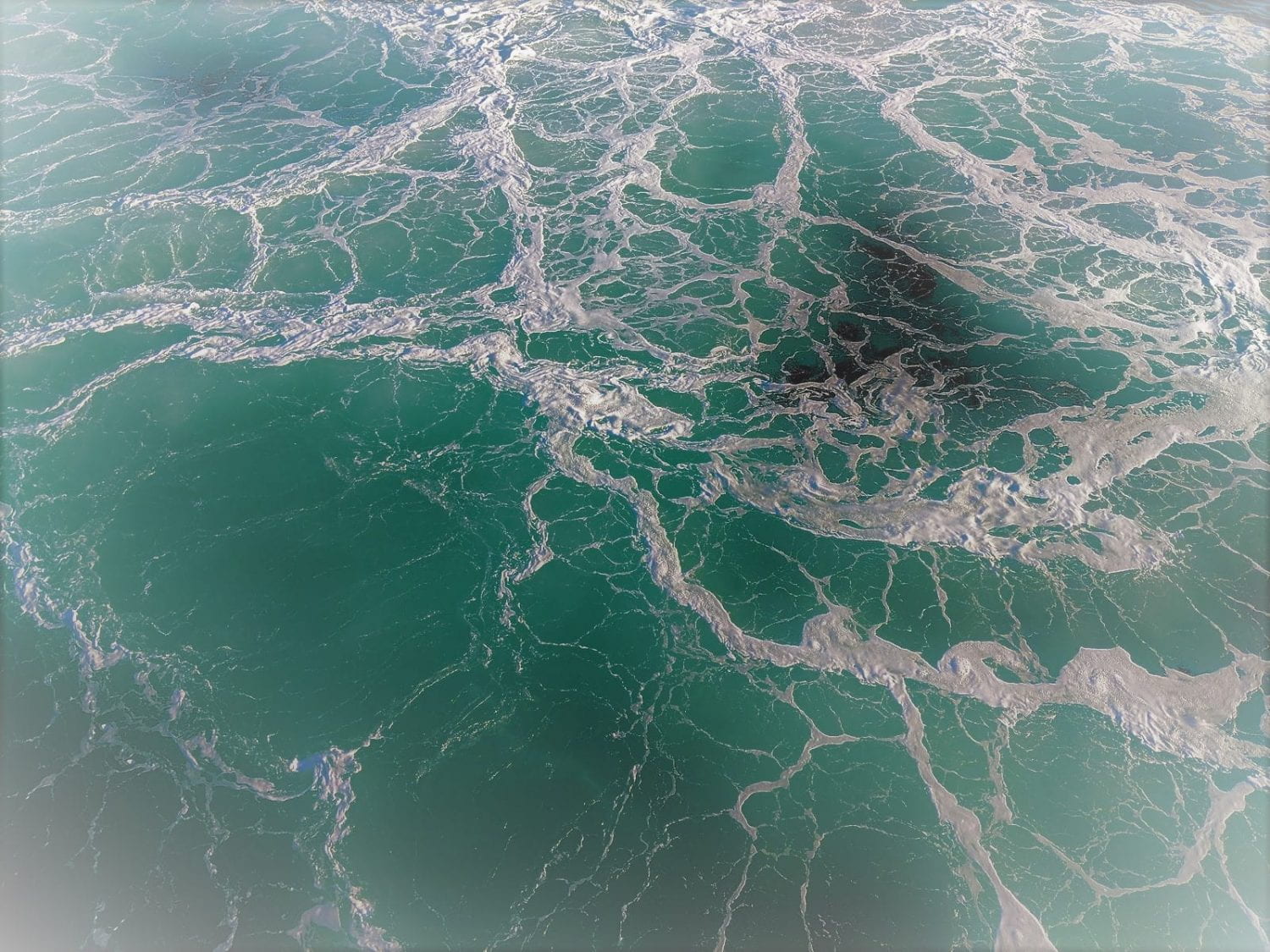
To enhance students’ spatial awareness and understanding of Salish Sea physical geographies, students each draw a Salish Sea place out of a hat and then have to talk amongst themselves to create a human map of the region.
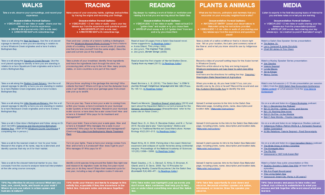
SALI Gameboard
This (virtual) lab component for the Introduction to the Salish Sea course supports students' engagement in independent experiential learning using walks, reading, podcasts, recorded lectures, and tracing local ecology.
-
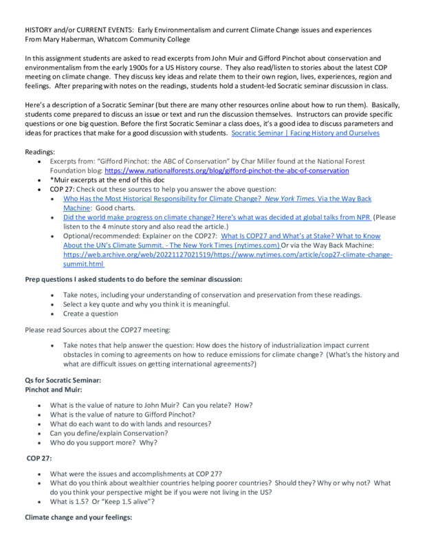 Environmentalism: Muir, Pinchot, COP 27Read excerpts from John Muir, Gifford Pinchot and articles on the latest COP meetings. Discuss views, issues, feelings about them.
 -
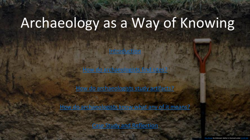 Archaeology Lesson PlanThe lesson introduces students to archaeology as a way of knowing the “deep history” of the Salish Sea and presents a brief review of the archaeology of the region. We also discuss the importance of this history to modern peoples today, including the necessity for archaeologists to collaborate with Indigenous communities.
 -
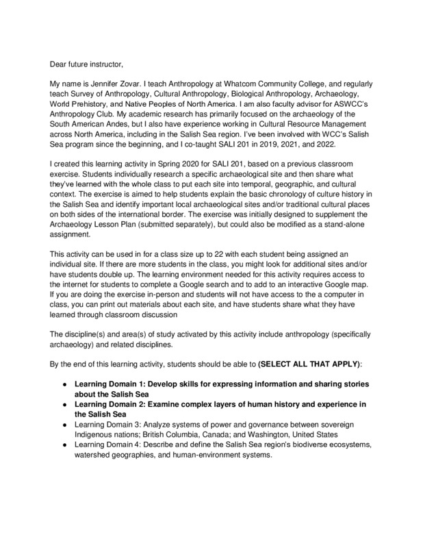 Mapping the Archaeological Past of the Salish Sea (MAPSS)The exercise is aimed to help students explain the basic chronology of culture history in the Salish Sea and identify important local archaeological sites and/or traditional cultural places on both sides of the international border.
 -
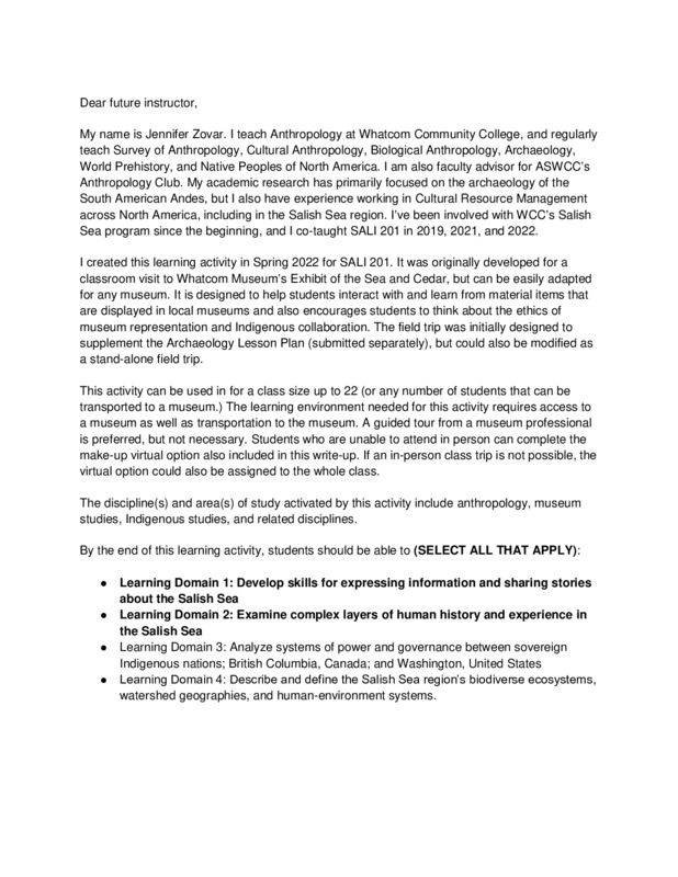 Museum VisitA field trip to a local museum allows students to interact with and learn from material items from the Salish Sea and also encourages students to think about the ethics of museum representation and Indigenous collaboration.
 -
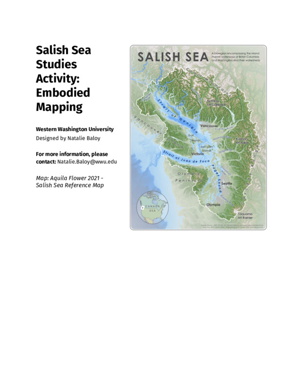 Embodied MappingStudents will deepen their knowledge of Salish Sea geography by creating a collective embodied map of assigned places.
 -
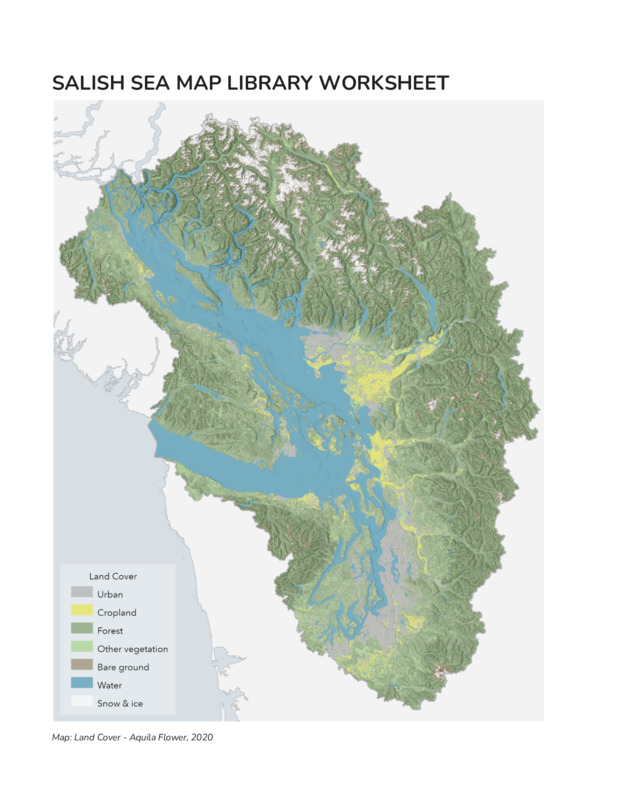 Map Library VisitStudents will engage their Salish Sea learning from different disciplinary perspectives through engaging with maps at a series of stations at the Map Collection.
 -
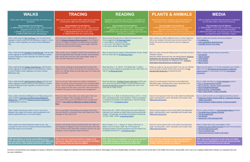 SALI Lab GameboardThis (virtual) lab component for the Introduction to the Salish Sea course supports students' engagement in independent experiential learning using walks, reading, podcasts, recorded lectures, and tracing local ecology.
 -
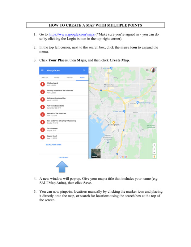 Creating a digital map with multiple pointsPin locations on a Google Map and share your research about the sites.
 -
 Virtual Field Exploration of Beaches in the Salish SeaStudents explore beaches in the Bellingham Bay virtually making observations and inferences and apply that to content they have learned.
 -
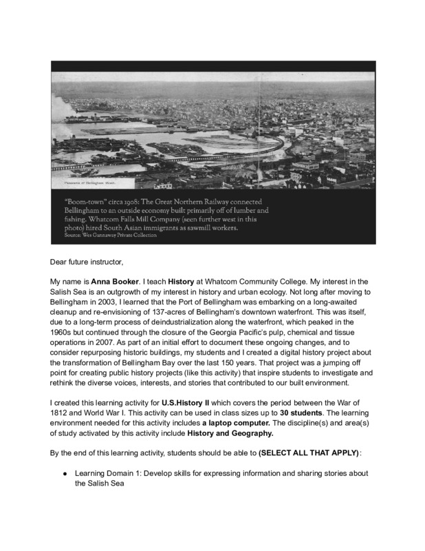 Creating a historical marker about a local history topicHow do we connect stories of people to place? The objective of this three-part project is to make the connection between the forced removal of Bellingham’s Punjabi community in 1907 to the history of Bellingham’s contested waterfront.
 -
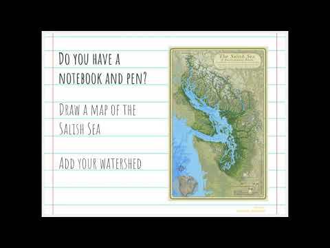 Find your watershedStudents learn how to use Google Maps and Google Images to find their watershed and get a sense of its topography and geography.
 -
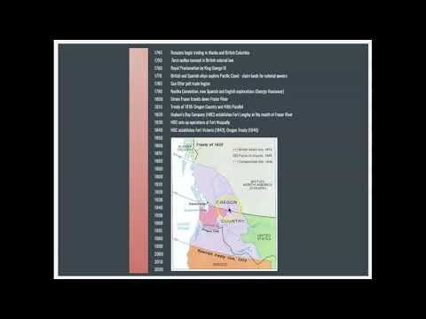 Settler colonial historiesAfter going through a timeline that covers the arrival of newcomers in the past three centuries, students journal their reflections on how colonialism shapes the past, present, and future. In the second video, students learn about concepts such as moving into a place, arrivants, guests, and write a 3-5 sentence positionality biography.
Image 1 credit: “Bellingham Bay Improvement Compnay Mill circa 1907”. Photo # X.4605. Curtesy of the Photo Archives of the Whatcom Museum.
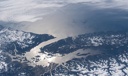
Image 2 credit: "The Strait of Juan de Fuca and the Salish Sea, pictured from the International Space Station, separate the western-most border of the United States and Canada". NASA, 2020. Public Domain.