Maps of the Salish Sea
-
-
The Waterlines Project MapMap by the Burke Museum shows an aerial view of the landscape of the area that now is Seattle in the mid-19th century before colonial settlement. It contains Coast Salish place names, ecosystems, and tours between locations.
-
Salish Sea Stream Discharge DiagramMap of Salish Sea major rivers and average stream discharge in cubic meters per second based on annual averages.
-
Salish Sea Land CoverMap of land cover in the Salish Sea bioregion with the categories of urban, cropland, forest, other vegetation, bare ground, water, snow and ice land cover modeled using 30x30 meter resolution gridded satellite data from 2015.
-
Salish Sea Population DensityMap of human population density in the Salish Sea as people per square kilometer mapped for each census block.
-
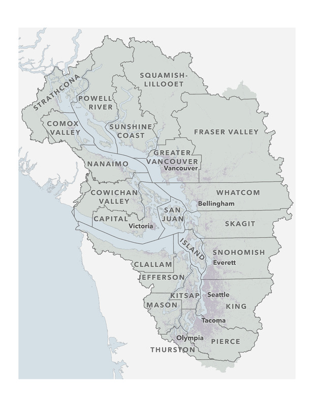 Salish Sea JurisdictionsMap of jurisdictions including U.S. counties, Canadian regional districts, and major cities (Bellingham, Everett, Olympia, Seattle, Tacoma, Vancouver, and Victoria) in the Salish Sea Bioregion.
 -
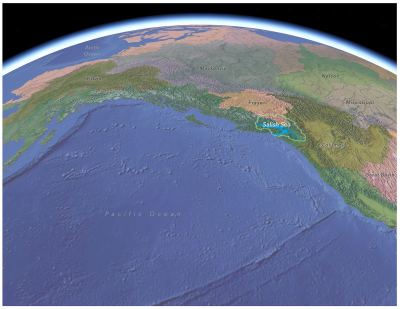 Salish Sea and Western North America Watersheds Contextual LandscapeMap of the Salish Sea’s surrounding watersheds in Western North America, including the Columbia, Fraser, Great Basin, Makenzie, Mississippi, Nelson, Yukon. The Pacific Ocean and Arctic Ocean are also visible.
 -
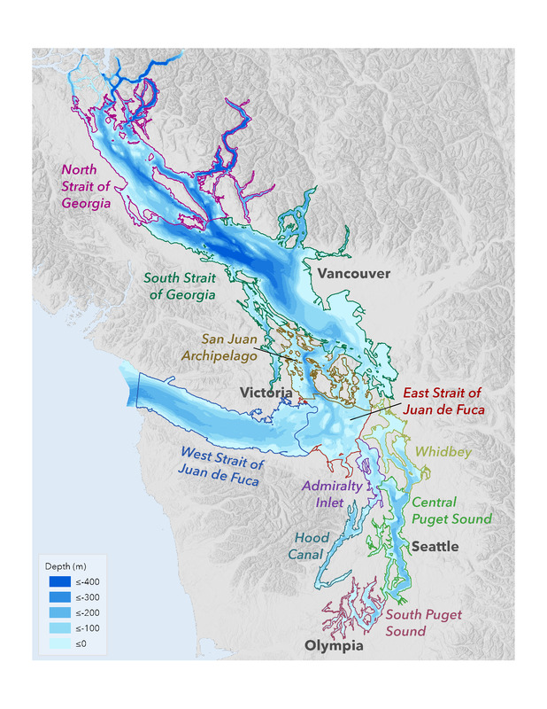 Marine BasinsMap of subbasins (or sub-basins) and bathymetry of the Salish Sea with basins delineated based on water depth and circulation. Shallower areas associated with underwater sills separate many of the basins, creating distinct oceanography. Basins shown include: Admiralty Inlet, Central Puget Sound, East Strait of Juan de Fuca, Hood Canal, South Puget Sound, San Juan Archipelago, South Strait of Georgia, Strait of Georgia, West Strait of Juan de Fuca, and Whidbey.
 -
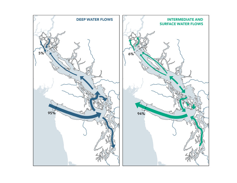 Salish Sea Circulation DiagramDiagram of deep water flows and intermediate and surface water flows in the Salish Sea. It provides direction and relative magnitude (line width) of net water flow and exchanges for marine waters and freshwater rivers.
 -
Map of the Salish Sea & Surrounding BasinMap of Salish Sea, with elevation and bathymetry data, extending from the north end of the Strait of Georgia to the south end of the Puget sound and west to the mouth of the Straight of Juan de Fuca. Map text focuses on natural features rather than political jurisdictions.
-
Washington's Air Monitoring NetworkInteractive Air Quality map created by the Washington Department of Ecology.
-
Washington Wildfire Map - Current Washington Wildfires, Forest Fires, and Lightning Strikes | Fire, Weather & Avalanche CenterInteractive real-time wildfire map for Washington.
-
-
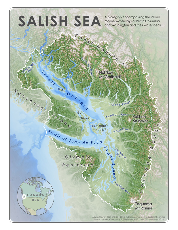
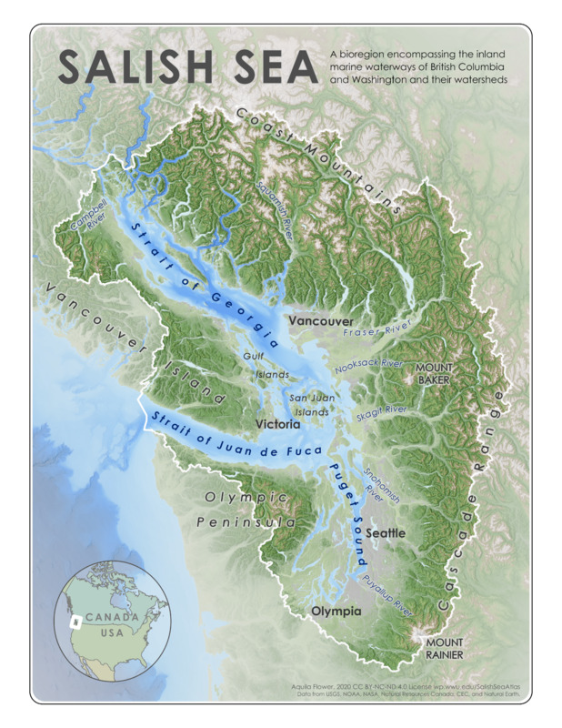 Reference Map for the Salish Sea BioregionA bioregion encompassing the inland marines waterways of British Columbia and Washington and their watersheds.