-
Title
-
Marine Basins
-
Description
-
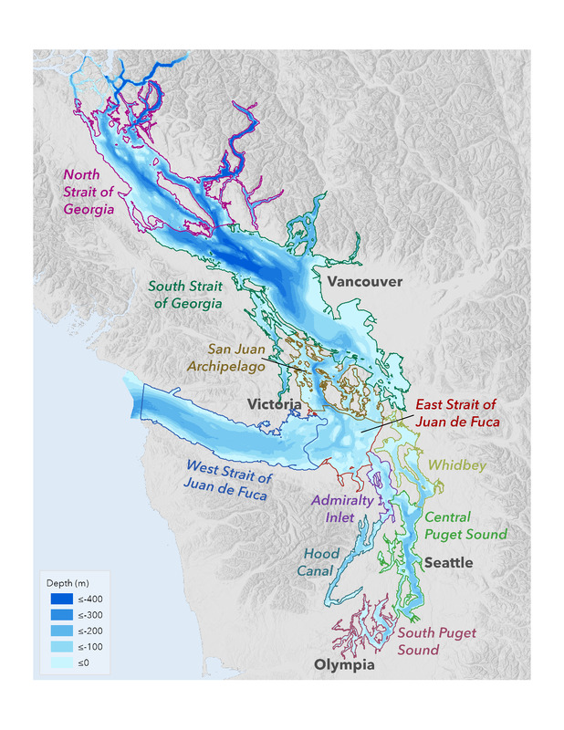
Map of subbasins (or sub-basins) and bathymetry of the Salish Sea with basins delineated based on water depth and circulation. Shallower areas associated with underwater sills separate many of the basins, creating distinct oceanography. Basins shown include: Admiralty Inlet, Central Puget Sound, East Strait of Juan de Fuca, Hood Canal, South Puget Sound, San Juan Archipelago, South Strait of Georgia, Strait of Georgia, West Strait of Juan de Fuca, and Whidbey.
-
Abstract
-
Subbasins and bathymetry of the Salish Sea. Basins are delineated based on water depth and circulation. Shallower areas associated with underwater sills separate many of the basins, creating distinct oceanography.
-
Type
-
map
-
Date
-
2021
 PDF Marine Basins