Mapping the Archaeological Past of the Salish Sea (MAPSS)
- Activity
- Mapping the Archaeological Past of the Salish Sea (MAPSS)
- Lesson description
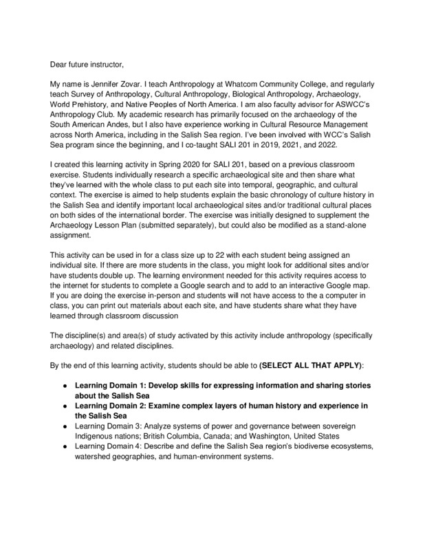
- The exercise is aimed to help students explain the basic chronology of culture history in the Salish Sea and identify important local archaeological sites and/or traditional cultural places on both sides of the international border.
- Discipline
- Social Sciences
- Spatial coverage
- Across the Salish Sea
- Course modality
- Online asynchronous
- Temporal coverage
- Since Time Immemorial
- Estimated time for students to complete activity
- Two hours
- Creator
- Jennifer Zovar
- Institutional affiliation
- Whatcom Community College
- License
- Creative Commons Attribution
- Type
- Activity (for example: field trip, lesson plan, lecture)
- Media
-
 PDF SALI Maps
Linked resources
Part of Mapping the Archaeological Past of the Salish Sea (MAPSS)