Anthropology journal article about community-based work for Edmonds Community College students’ place-based learning, Coast Salish partners’ and native students’ requests for involvement and “passing the mic,” and the role and uses of ethnography for tribal and non-tribal governments.
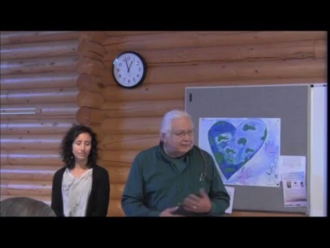
Swinomish Indian Tribal Community Tribal Historical Preservation Officer Larry Campbell (Swinomish) and Environmental Community Health Analyst Jamie Donatuto present at the Northwest Indian College Salish Sea Speaker Series. They talk about why Indigenous-specific health indicators, respected stewardship, community connections, and diet matter.
Booklet on the community involvement shaping the 50-year plan for Seattle’s water resilience called Shape Our Water. In collaboration with Seattle Public Utilities, it provides goals for creating a water-resilient and equitable future in Seattle with infrastructure that supports community needs and addresses underlying issues.
Episode from the podcast Book Club with Jeffery Sachs features a conversation with author Roxanne Dunbar-Ortiz. They discuss myths, settler colonialism, white supremacy, and the history of erasure and exclusion in the United States.
Reimagining the history of Bellingham Bay and North Puget Sound and how it is taught, presented by Anna Booker, WCC history instructor, and the "Bellingham Working Waterfront Project" and David Jepsen, co-author of Contested Boundaries: A New Pacific Northwest History.
Whatcom County Historical Society and Whatcom Museum host a presentation on the results from projects about experiential learning and storytelling for critical thinking. Booker discusses the Salish Sea Virtual Lab that supports experiential learning.
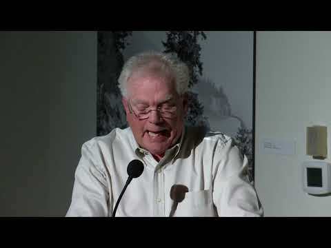
Western Washington University television show episode follows Bert Webber, who led the naming of the Salish Sea composed of the Puget Sound, Strait of Georgia, and Strait of Juan de Fuca. Webber explains that the name provides a greater understanding of the ecological and cultural roots of the region.
Essay detailing the history of how railroad expansion and Washington coal mines for fuel and export shaped the economy and society of the Puget Sound. The essay also contains historical photographs from coal mines.
Article from The Railway and Locomotive Historical Society Bulletin on railroad history in Bellingham Bay and British Columbia from 1852 to 1951. The article also contains relevant maps, photographs, and data.
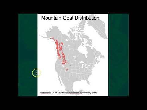
Marco Hatch (Samish) lectures about the mountain goat (Oreamnos americanus), which is native to the Salish Sea. He discusses characteristics, distribution, removal from Olympic National Park, and the role of wool for Coast Salish peoples.
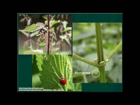
Marco Hatch (Samish) lectures about stinging nettle (Urtica diotca). He discusses nettle distribution, characteristics, and harvesting for nutritional and medicinal use.
Marco Hatch (Samish) lectures about Pacific Silverweed (Argentina egedii). He discusses plant distribution, characteristics, consumption, nutrients, and relation to food-related Traditional Ecological Knowledge.
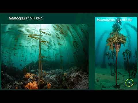
Marine ecologist Marco Hatch (Samish) lectures about kelp forests in the Salish Sea. He focuses on the characteristics, life stages, role, distribution, and restoration of two species: bull kelp (Nereocystis luetkeana) and giant kelp (Macrocystis pyrifera).
Clip about the archaeology of root gardens composed of Pacific Silverweed and Springbank Clover, which serve as traditional food sources for Indigenous peoples in the Salish Sea.
Longhouse Media presents a documentary about the Samish Legend of Ko-kwal-alwoot, who risked her life to save the Samish people from starvation. The film explains the story, its pole carving on Rosario Beach in Deception Pass State Park, and the importance of the history to the Samish people.
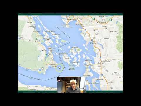
Marco Hatch (Samish) provides a brief overview of the Salish Sea for the Western Washington University course SALI 201: Introduction to the Salish Sea. He introduces the map, terminology, borders, treaties and rights, and tribal territories.
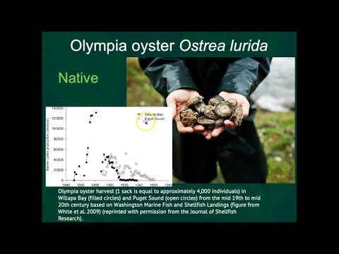
Marine ecologist Marco Hatch (Samish) lectures about shellfish and soft substrate intertidal zones. He discusses and compares the characteristics of the Varnish Clam, Olympia Oyster, Pacific Oyster, Manila Littleneck Clam, Native Littleneck Clam, Cockle Clam, Butter Clam, Horse Clam, and Geoduck.
Video by Northwest Straits Foundation and The Shore Friendly program shows how the geology and physical processes that form Puget Sound beaches impact those who live on them.
ArcGIS StoryMap by U.S. Fish and Wildlife Service about the Middle Fork Nooksack River Diversion Dam near Deming, Washington, a source of drinking water for the City of Bellingham. It discusses public and private partnerships for dam removal that would benefit wildlife (like salmon, steelhead, and bull trout migration) and people.
ArcGIS StoryMap by Northwest Straits Foundation about the projects Derelict Gear Removal (like crab pots, fishing nets, and shoreline armor) and Shore Friendly (and the Landowner Outreach Program), which restore beach and marine habitat.
Documentary by Hakai Institute follows a team of archaeologists who are looking for evidence of humans in the Discovery Islands off Vancouver Island, British Columbia. The film focuses on understanding environmental change and adaptation after the ice age.
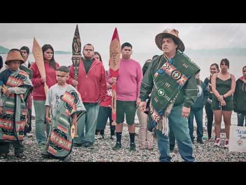
Documentary about how the Lummi Nation led the opposition to a proposal for a coal terminal at Cherry Point near Bellingham, Washington. Cherry Point is an ancestral village site and integral to fishing treaty rights for the Lummi Nation.
ArcGIS StoryMap by the Salish Sea Marine Survival Project shows the research of factors impacting the survival of juvenile salmon and steelhead in the Salish Sea for better recovery and management. It discusses the importance of eelgrass meadows and bull kelp habitat, the impact of climate change, and restoration efforts.
Seattle Public Library presents a collection of historic photographs of Washington State locations like the Olympic Peninsula, Mount Rainier, Deception Pass, Bellingham, Tacoma and Eastern Washington.
City of Bellingham presents a video covering the steps of cleaning wastewater at the Post Point Resource Recovery Plant starting from when it leaves a house to when it reaches Bellingham Bay.
Book by Lindsay Keegitah Burrows (Anishinaabe) uses storytelling of a journey through Anishinaabe, Inuit, Maori, Coast Salish, and Abenaki territories to explore Indigenous language and law revitalization.
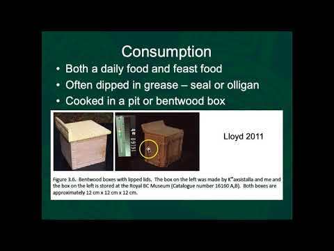
Human ecology journal article explores clam garden management techniques as a form of Indigenous Traditional Ecological Knowledge. Based on accounts from Kwakwaka'wakw Clan Chief Kwaxistalla Adam Dick, trained in these techniques by elders, the article discusses activities, motivations, and outcomes of clam gardens.
Autobiographical account of Harriette Shelton Dover’s (Snohomish) life in the Tulalip Reservation Community and her stories of the hardships of resettlement and traumatic experiences in an Indian boarding school. Dover describes her tribe’s strong community and connection to land.
Environmental science journal article evaluates the patterns of exploitation of oysters and oyster reef degradation due to destructive fishing practices. The article focuses on estuaries in western North America (Ostreola conchaphila), eastern North America (Crassostrea virginica), and eastern Australia (Saccostrea glomerata).
Historical fiction novel set in late 19th century Bellingham Bay, Washington follows three men navigating pioneer life among European settlers and a group of Lummi natives.
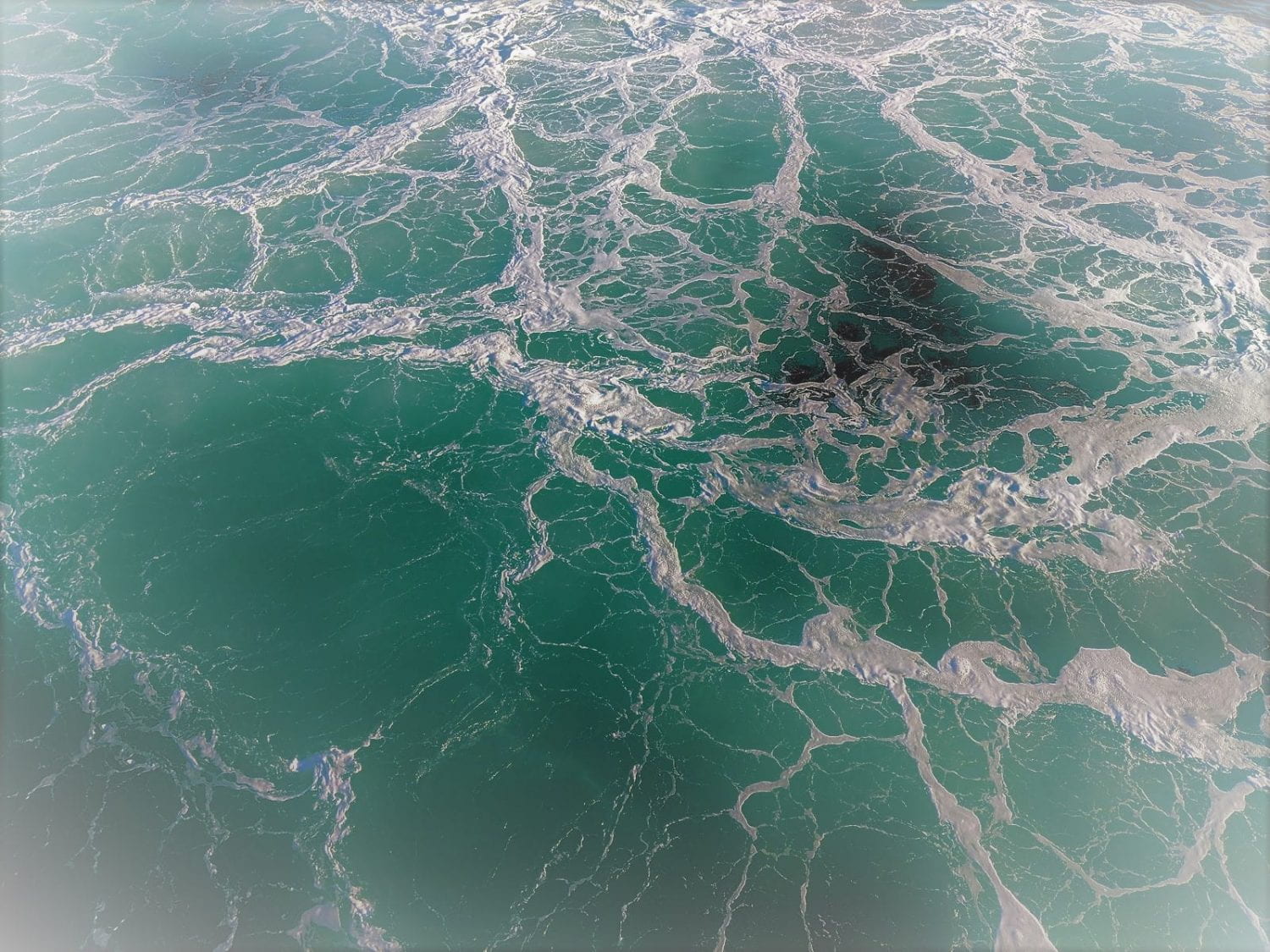
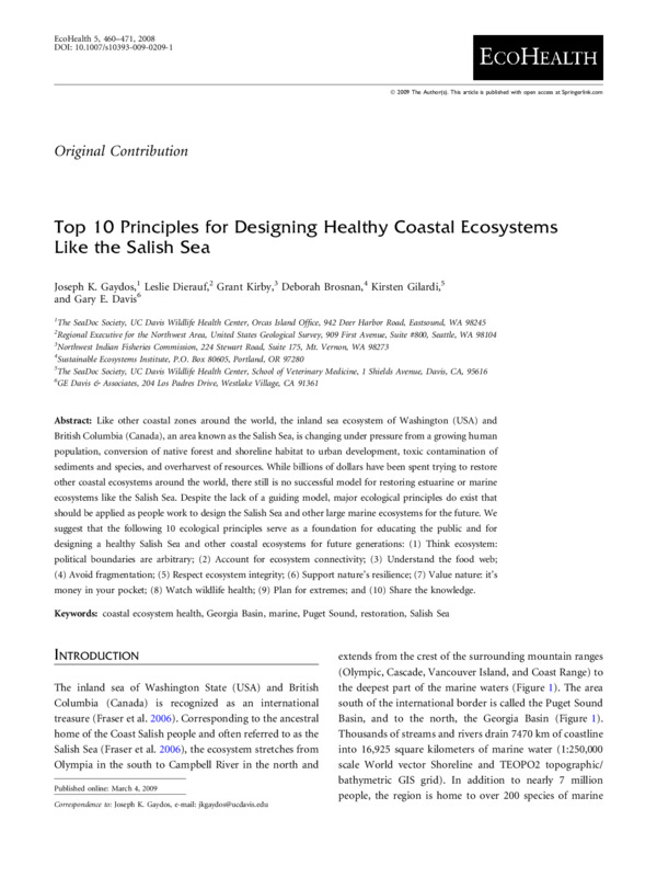
Like other coastal zones around the world, the inland sea ecosystem of Washington (USA) and British Columbia (Canada), an area known as the Salish Sea, is changing under pressure from a growing human population, conversion of native forest and shoreline habitat to urban development, toxic contamination of sediments and species, and overharvest of resources. While billions of dollars have been spent trying to restore other coastal ecosystems around the world, there still is no successful model for restoring estuarine or marine ecosystems like the Salish Sea. Despite the lack of a guiding model, major ecological principles do exist that should be applied as people work to design the Salish Sea and other large marine ecosystems for the future. We suggest that the following 10 ecological principles serve as a foundation for educating the public and for designing a healthy Salish Sea and other coastal ecosystems for future generations.
Website describing the Squamish Nation's sustainable economic development and design project on Sen̓áḵw Lands, a Squamish Village location that was located where Vancouver City, British Colombia is today. The project focuses on reconciliation and Squamish leadership with climate, urban development, and economic development.
Podcast series by Autumn Brown and adrienne maree brown, who are writers, activists, and facilitators. The podcast focuses on community practices and learning in the midst of endings and apocalypse.
Episode of Emergence Magazine Podcasts features an essay written and spoken by Robin Wall Kimmerer (Citizen Potawatomi Nation) about reciprocity in the gift economy and learning from Indigenous wisdom about currencies of exchange while harvesting serviceberries alongside birds.
Hawai’i Public Radio presents a news article about a modified plan for the Ala Wai Flood Control Project after public resident opposition. The Army Corps of Engineers proposed a method to reduce flood risk and increase climate adaptation in the Ala Wai Watershed for residents living along the Makiki, Mānoa, and Pālolo streams.
U.S. Army Corps of Engineers website page providing details on the Ala Wai Flood Risk Management Project and overview, location, flooding impact, and flood risk of the Ala Wai Watershed.
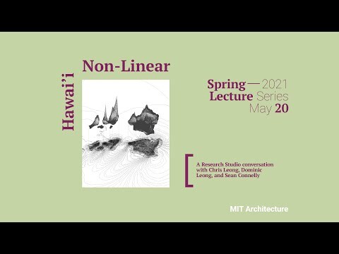
Massachusetts Institute of Technology Architecture Lecture Series presents a Research Studio conversation about the empowerment of Indigenous Hawaiian Knowledge and the ecological devastation and racial injustices of U.S. settler colonialism. Hawai’i Non-Linear connects the lifestyle of Indigenous Knowledge to architecture.
Canadian Broadcasting Corporation news presents a story about the impacts of British Columbia, Canada highway closures due to flooding and landslides. Truckers work to reduce supply chain disruption.
The Urbanist presents a news article on proposals for high-speed transit between hub cities to improve housing affordability and reduce environmental concerns during continued development of the Cascadia mega-region, including Seattle, Portland, and Vancouver, British Columbia.
The Urbanist presents an article that argues that the Canada Vision 2050 proposal to develop four hub cities from British Columbia to Oregon for development will not sufficiently support growth. The article offers other ways to promote sustainable development and growth.
Microsoft presents a video about the proposed collaboration between Seattle, Washington and Vancouver, British Columbia for a corridor for connectivity, productivity, and innovation.
National Public Radio presents a podcast episode about Indigenous youth activists at the U.N. climate summit in Glasgow, Scotland. Indigenous activists from around the world talk about the impacts of colonialism on the lack of access to the conference.
Sightline Institute presents an article on the negative impacts of Washington State oil refineries’ air and water pollution on human health and wildlife. The article discusses health risks, Clean Air Act violations, and impacts on communities like Anacortes, Ferndale, Tacoma and the Swinomish Tribe.
Sightline Institute presents an article on oil refinery profits and tax payments in Washington State. The article discusses the economic impacts and environmental costs of the industry.
Sightline Institute presents an article on oil refinery employment in Washington State, especially Whatcom and Skagit counties. It discusses pay, safety, and a history of striking to demand safer working conditions.
Sightline Institute presents an article on possible futures for oil refining in Washington State as climate change shifts energy demands away from oil.
Report from Cascadia Consulting Group discusses the purpose and progress of the task force to develop recommendations addressing the decline of the Southern Resident orca population and the threats of extinction due to less Chinook salmon, disturbance from traffic, toxic contaminants, and climate change and population growth.